
The following are what are known as dependencies. They are not countries recognised by the United Nations, however, they have a large amount of control over their own affairs but are actually dependent on another country for certain things, usually defence and international representation. We are treating them differently to the recognised countries, giving you less information.


Back to the Flags of Europe page
 The seven dependencies in Europe, together with their sovereign country, are:-


The seven dependencies in Europe, together with their sovereign country, are:-
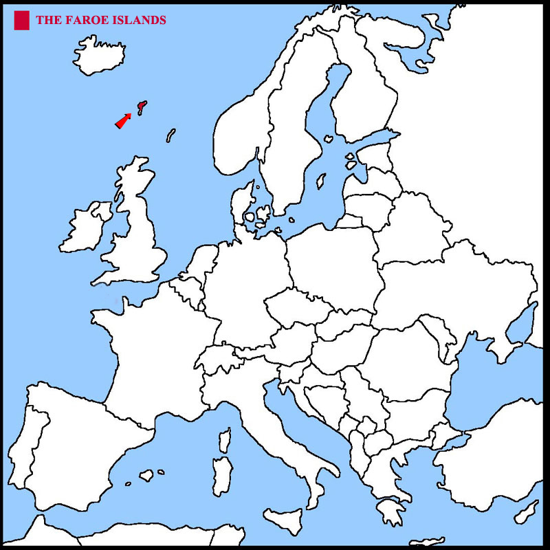
THE FAROE ISLANDS
The Faroe Islands are a collection of some 18 major islands (and a total of 779 islands, islets, and skerries) about 655 kilometres (407 miles) off the
coast of Northern Europe, between the Norwegian Sea and the North Atlantic Ocean, about halfway between Iceland and Norway.
The geographical coordinates for the The Faroe Islands, also known as lines of latitude and longitude, are:-
Latitude 62 00N
Longitude 7 00E.
The Islanders are largely descended from Viking settlers who arrived in the 9th century. The islands have been connected politically to
Denmark since the 14th century. A high degree of self-government was granted to the Islanders in 1948. They have control over most internal affairs while
Denmark is responsible for justice, defense, and foreign affairs. The Faroe Islands are not part of the European Union.
The weather is cool summers and fairly mild winters but generally windy and cloudy and the time is the same as the United Kingdom.
The Faroe Islands have a total area of 1,393 sq kms.
They have a total coastline of 1,117 kms and have no land borders.
They have a total population of 50,730.
Below is a map showing where the Faroe Islands are and the flag of the Faroe Islands.
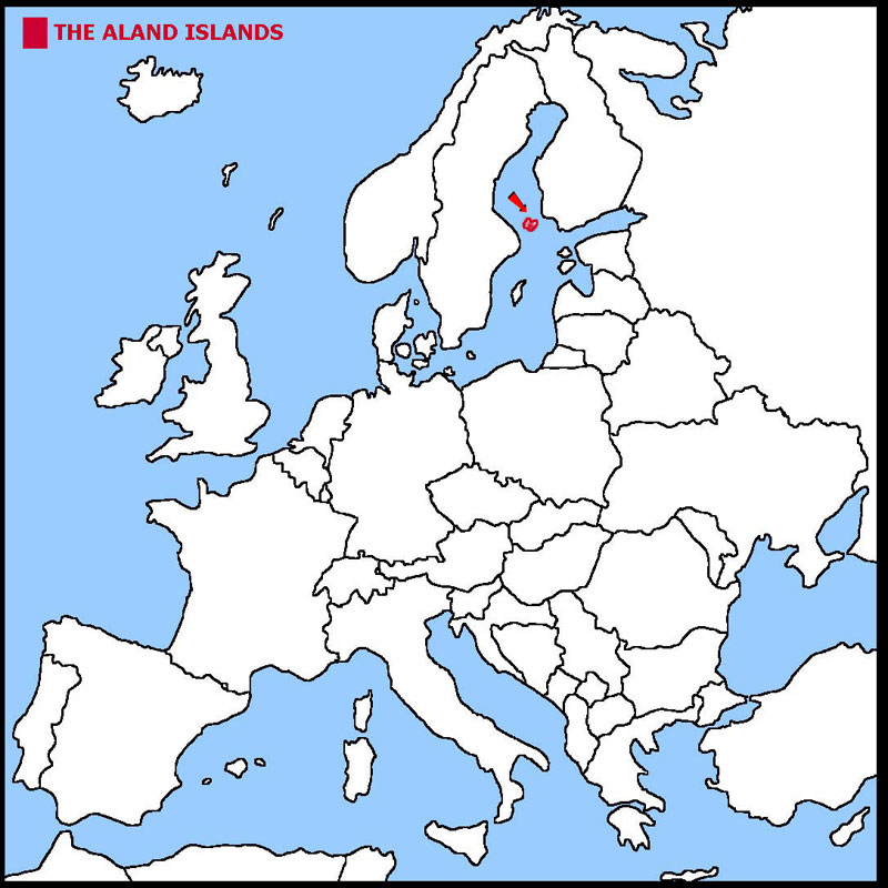
THE ALAND ISLANDS
The Aland Islands are a collection of some 6,700 islands, only 90 of them inhabited, which are situated off the south west coast of Finland.
The geographical coordinates for the The Aland Islands, also known as lines of latitude and longitude, are:-
Latitude 60 00N
Longitude 20 00E.
The islands were disputed between Finland and Sweden for many years but, in 1917, it was decided, by the newly formed League of Nations, that
Finland would retain control but the people could pursue their own culture. It is now the only part of Finland where the inhabitants nearly all speak Swedish.
The weather is similar to Finland although summers are cooler and the time is the same as Finland.
The Aland Islands have a total area of 1,527 sq kms.
They have a total coastline of 8,271 kms and have no land borders.
They have a total population of 29,013.
Below is a map showing where they are and the flag of the Aland Islands.
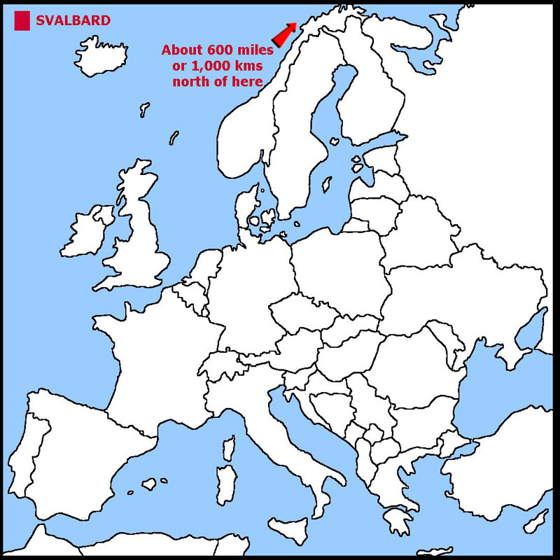
SVALBARD
Svalbard is a group of nine main islands within the Arctic Circle. As such it has non-stop daylight for almost 6 months of the year and darkness for
the other six months. Much of the land is rugged mountains and most of it covered in ice. There are fjords along the western and northern coasts.
The geographical coordinates for Svalbard, also known as lines of latitude and longitude, are:-
Latitude - 78 00N
Longitude 20 00E.
Svalbard is a region of Norway. Norway's sovereignty was officially recognised by a treaty in 1920. Before that it had been a whaling station.
Coal mining now takes place on the islands. There is a governor appointed by Norway, while the main settlement, Longyearbyen, has an elected council.
Tax in Svalbard is lower than in Norway and there is no VAT. The weather is arctic, meaning cool summers and cold winters. The warm North Atlantic Current
keeps the waters around the islands navigable most of the year. The time is the same as in Norway.
Svalbard has a total area of 62,045 sq kms.
It has a total coastline of 3,587 kms and has no land borders.
It has a total population of 2,667.
Below is a map showing where Svalbard is and the flag of Svalbard (they use the Norwegian Flag).
THE ISLE OF MAN
The Isle of Man is an island in the Irish Sea. It is possible, on a clear day, to see England, Scotland, Wales and Ireland from the Isle of Man.
The land is hilly in the north and south with a valley across the middle. The Isle is famous for the motorcycle TT races held each year.
The geographical coordinates for the Isle of Man, also known as lines of latitude and longitude, are:-
Latitude - 54 15N
Longitude - 4 30W.
The Isle of Man was part of the Viking Norwegian Kingdom until given to Scotland in 1266AD. It came under British rule in 1765. It is not part of
the UK nor of the EU. The Tynwald, the Isle of Man parliament, claims to be the oldest in the world and celebrated 1,000 years in 1979. The UK is
responsible for the defence and international representation of the Isle of Man. The weather and time are the same as the United Kingdom.
The Isle of Man has a total area of 572 sq kms.
It has a total coastline of 160 kms and has no land borders.
It has a total population of 88,195,
Below is a map showing where the Isle of Man is and the flag of the Isle of Man.

GUERNSEY
Guernsey and the neighbouring islands of Alderney, Herm and Sark, are several of a number of islands in the English Channel but far closer to the northern coast
of France. The islands were originally part of the lands ruled by William of Normandy who conquered England in 1066AD and they have remained under
English control.
The geographical coordinates for Guernsey, also known as lines of latitude and longitude, are:-
Latitude - 49 28N
Longitude - 2 35W.
The islands of Guernsey, Alderney, Herm and Sark are, essentially, self-governing. Together they are known as the Balliwick of Guernsey.
A Balliwick is an area administered by a baliff. They are not part of the UK nor part of the European Union. The UK is responsible for the defence and
international representation of the Balliwick. Guernsey, Alderney and Sark were all occupied by the Germans in WWII. The weather is temperate with mild winters and cool, dry summers and the time is the same as the UK.
Guernsey, Alderney, Herm and Sark have a total area of 78 sq kms.
They have a total coastline of 50 kms and have no land borders
They have a total population of 66,297.
Below is a map showing where the Balliwick of Guernsey is and the flag of Guernsey.

JERSEY
Jersey is one of a number of islands in the English Channel but far closer to the northern coast of France. The islands were originally part of the lands
ruled by William of Normandy who conquered England in 1066AD and have remained under English control.
Latitude - 49 15N
Longitude - 2 10W.
Jersey is a self governing parliamentary democracy with the Queen of England as its Head of State. There is a Lieutenant Governor on the island who represents the Queen. Jersey is not part of the UK nor part of the European Union. The UK is responsible for the defence of Jersey. Jersey was occupied by the Germans in WWII. The weather is temperate with mild winters and cool, dry summers and the time is the same as the UK.
Jersey has a total area of 116 sq kms.
It has a total coastline of 70 kms and has no land borders.
It has a total population of 98,069.
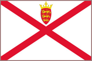
Below is a map showing where Jersey is and the flag of Jersey.

GIBRALTAR
Gibraltar occupies a very small, rocky piece of land at the southern end of Spain and is at the opening where the Mediterranean Sea joins the Atlantic Ocean.
There is small lowland area at the foot of the rock.
The geographical coordinates for Gibraltar, also known as lines of latitude and longitude, are:-
Latitude - 36 08N
Longitude - 5 21W.
Gibraltar was given to Great Britain by Spain in the 1713 Treaty of Utrecht. It was declared a British colony in 1830. In a referendum held in 1967,
Gibraltarians voted overwhelmingly to remain a British dependency. Sovereignty has been disputed between Spain and the United Kingdom for many years.
Spain renewed its demands for an eventual return of Gibraltar to Spanish control after the UKs June 2016 vote to leave the EU, but London has said
there is no connection between that vote and who controls Gibraltar. Gibraltar has control over many aspects of life on the rock but the United Kingdom retains responsibility for defence, foreign relations, internal security,
and financial stability. Gibraltar is important because of its position at the entrance to the Mediterranean Sea. The weather and time are the same as Spain.
Gibraltar has a total area of 6.5 sq kms.
It has a total coastline of 12 kms and a border of 1.2 kms with Spain.
It has a total population of 29,328.
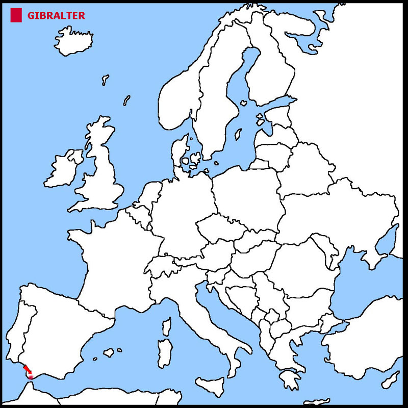
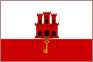
Below is a map showing where Gibraltar is and the flag of Gibraltar.
![]()