
The following are what are known as dependencies. They are not countries recognised by the United Nations, however, they have a large amount of control over their own affairs but are actually dependent on another country for certain things, usually defence and international representation. We are treating them differently to the recognised countries, giving you less information.


Back to the Flags of Asia page
 The six dependencies in Africa, together with their sovereign country, are:-


The six dependencies in Africa, together with their sovereign country, are:-
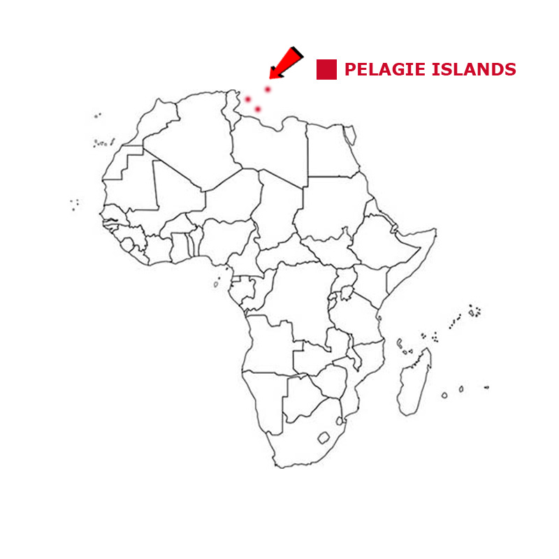
PELAGIE ISLANDS
The Pelagie Islands are three small islands in the Mediterranean Sea. They are situated between Tunisia and Malta, south of Sicily.
The geographical coordinates for Christmas Island, also known as lines of latitude and longitude, are:-
Latitude 35 51N
Longitude 12 60E.
The islands are the southernmost part of Italy and are under the administrative control of Sicily. Two beaches on the island are the last remaining sites where the Loggerhead Sea Turtle The land these days is fairly barren after excessive deforestation. The economy is built on fishing and tourism on the largest island of Lampedusa. Linosa and Lampione are the smaller islands.
The weather is Mediterranean with hot dry summers and warm winters with moderate rainfall.
The Pelagie Islands have a total land area of 26 sq kms.
They have a total coastline of about 30 kms and have no land borders.
They have a total population of 6,066.
Below is a map showing where the Pelagie Islands are and the flag of the Pelagie Islands. The Pelagie Islands uses the Italian national flag.
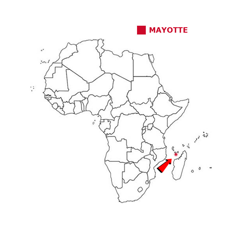
MAYOTTE
Mayotte consists of a main island, Grande-Terre, a smaller island, Petite-Terre,, and several smaller islets.
The geographical coordinates for Mayotte, also known as lines of latitude and longitude, are:-
Latitude - 12 50S
Longitude 45 08E.
Mayotte is part of the Comoros group of islands but in a 1974 referendum was the only group of islands which voted to remain as an overseas department of France. It is a densely populated country. The main language is Shimaore. The weather in Mayotte is tropical, with a hot, humid and rainy season from December to April and a relatively cool, dry and sunny season from June to October.
Mayotte has a total area of 374 sq kms.
They have a total coastline of 185 kms and have no land borders.
Mayotte has a total population of 270,372.
Below is a map showing where Mayotte is and the flag of Mayotte.

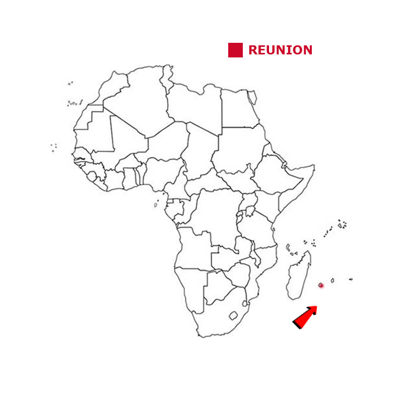
REUNION
Reunion is an overseas department and region of France and an island in the indian Ocean, east of Madagascar.
The geographical coordinates for Reunion, also known as lines of latitude and longitude, are:-
Latitude 21 06S
Longitude 55 31E.
The island has been inhabited since the 16th century, when people from France and Madagascar settled there. It is above a hotspot in the Earth's crust and a volcano on the eastern end of the island has erupted over 100 times since 1640, the last major eruption being in 2017. The weather is cool and dry from May to November, but hot and rainy from November to April. Réunion holds the world records for the most rainfall in 12-, 24-, 72- and 96-hour periods.
Reunion has a total area of 2,511 sq kms.
It has a total coastline of about 250 kms. It had no land borders.
It has a total population of 866,506 people.
Below is a map showing where Reunion is and the flag of Reunion.
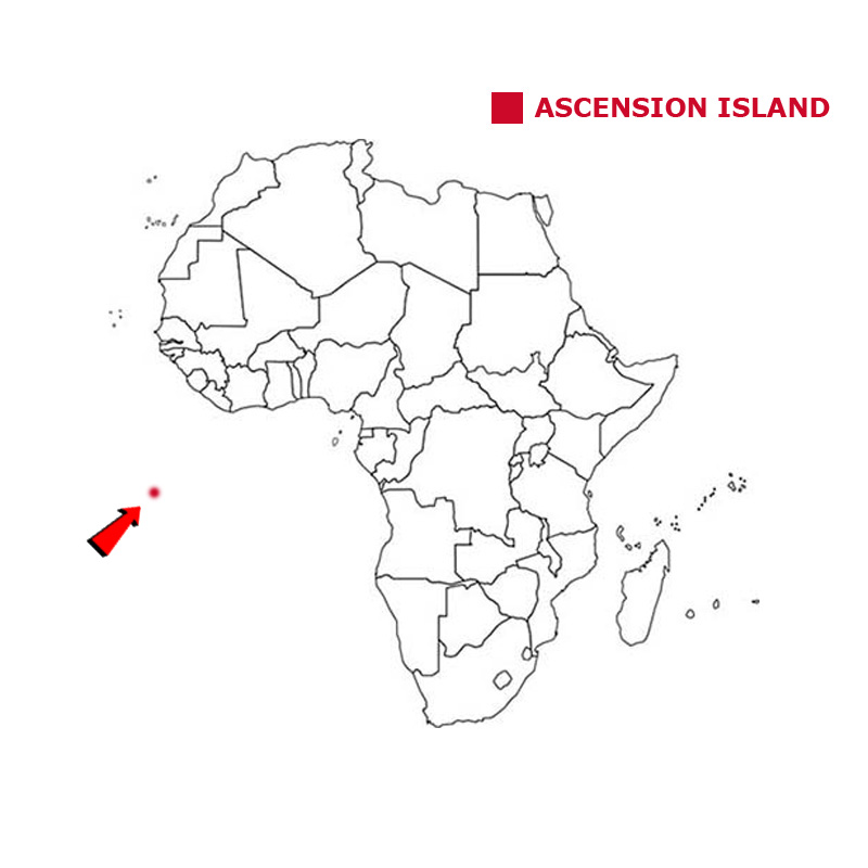
ASCENSION ISLAND
Ascension Island is an isolated volcanic island in the South Atlantic Ocean.
The geographical coordinates for Ascension Island, also known as lines of latitude and longitude, are:-
Latitude 7 56S
Longitude 14 25W.
Ascension Island is part of the British Overseas Territory of Saint Helena, Ascension Island and Tristan da Cunha. The island is named after the day of its recorded discovery. It was used as a supply station for British aircraft and ships during the Falklands War. It also is where the BBC has its World Service tracking station. The weather on Ascension Island is tropical but with lower than normal rainfall. The heaviest rain is between June and September.
Ascension Island has a total area of 88 sq kms.
It has a total coastline of about 40 kms. It has no land borders.
It had a total population of 806.
Below is a map showing where Ascension Island is and the flag of Ascension Island.

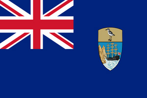
SAINT HELENA
Saint Helena is an isolated volcanic island in the South Atlantic Ocean.
The geographical coordinates for Saint Helena, also known as lines of latitude and longitude, are:-
Latitude 15 56S
Longitude 5 43W.
Ascension Island is part of the British Overseas Territory of Saint Helena, Ascension Island and Tristan da Cunha. Saint Helena is Britain's second-oldest overseas territory after Bermuda. Napoleon Bonaparte was finally sent to Saint Helena after his defeat at Waterloo. He arrived in October 1815 and died on the island in May 1821. The weather on Saint Helena is tropical.
Saint Helena has a total land area of 121 sq kms.
It has a total coastline of about 60 kms. It has no land borders.
It has a total population of 4,534.
Below is a map showing where Saint Helena Island is and the flag of Saint Helena Island.

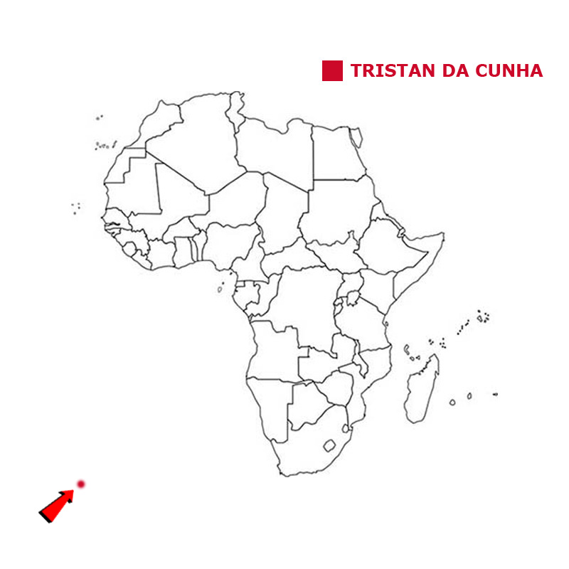
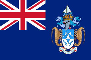
TRISTAN DA CUNHA
Tristan da Cunha is a remote group of four volcanic islands in the South Atlantic Ocean.
The geographical coordinates for Tristan da Cunha, also known as lines of latitude and longitude, are:-
Latitude 37 04S
Longitude 12 19W.
Tristan da Cunha is part of the British Overseas Territory of Saint Helena, Ascension Island and Tristan da Cunha. The main island, also called Tristan da Cunha, is the only inhabited island although a small group do live on Gough Island in order to carry out weather observations. In 1961 a volcanic eruption forced all the islanders to flee the main island. They were eventually brought to Britain and housed in an old RAF camp in Hampshire. Most returned in 1963. The weather in Tristan da Cunha is subtropical with mild summers and winters and very little change in rainfall over the year.
Tristan da Cunha, as a group, has a total land area of 207 sq kms.
The four island have a total coastline of about 150 kms. It has no land borders.
It has a total population of 293.
Below is a map showing where Tristan da Cunha is and the flag of Tristan da Cunha.
![]()