
The following are what are known as dependencies. They are not countries recognised by the United Nations, however, they have a large amount of control over their own affairs but are actually dependent on another country for certain things, usually defence and international representation. We are treating them differently to the recognised countries, giving you less information.


Back to the Flags of North America page
 The twenty one dependencies in North America, together with their sovereign country, are:-
- San Andres - Colombia
- Greenland - Denmark
- Guadeloupe - France
- Martinique - France
- St Barthelemy - France
- St Martin - France
- St Pierre and Miquelon - France
- Aruba - Netherlands
- Bonaire - Netherlands
- Curacao - Netherlands
- Saba - Netherlands
- Sint Eustatius - Netherlands
- Sint Maarten - Netherlands
- Anquilla - United Kingdom
- Bermuda - United Kingdom
- British Virgin Islands - United Kingdom
- Cayman Islands - United Kingdom
- Montserrat - United Kingdom
- Turks and Caicos Islands - United Kingdom
- Puerto Rico - United States of America
- US Virgin Islands - United States of America


The twenty one dependencies in North America, together with their sovereign country, are:-
- San Andres - Colombia
- Greenland - Denmark
- Guadeloupe - France
- Martinique - France
- St Barthelemy - France
- St Martin - France
- St Pierre and Miquelon - France
- Aruba - Netherlands
- Bonaire - Netherlands
- Curacao - Netherlands
- Saba - Netherlands
- Sint Eustatius - Netherlands
- Sint Maarten - Netherlands
- Anquilla - United Kingdom
- Bermuda - United Kingdom
- British Virgin Islands - United Kingdom
- Cayman Islands - United Kingdom
- Montserrat - United Kingdom
- Turks and Caicos Islands - United Kingdom
- Puerto Rico - United States of America
- US Virgin Islands - United States of America
SAN ANDRES
San Andres is a coral island situated in the Caribbean Sea. Together with the nearby, and slightly smaller islands of Providencia and Santa Catalina it forms the
Archipelago of San Andrés, Providencia and Santa Catalina and is a district of Colombia.
The geographical coordinates for San Andres, also known as lines of latitude and longitude, are:-
Latitude 12 35N
Longitude 81 42W - W indicates west of the Greenwich Meridian.
It consists of two island groups about 775 km (482 mi) northwest of mainland Colombia, and eight outlying banks and reefs. The largest island of the
archipelago is called San Andrés and its capital is San Andrés. Control of the islands was disputed for many years particularly between Colombia and Nicaragua
but the International Court of Justice has now ruled that Colombia has sovereignty over the islands.
The weather is typically Caribbean and, during the hurricane season, the islands are prone to being damaged by the strong winds that can occur.
The Archipelago has a total area of 52.5 sq kms, of which San Andres is 26 sq kms.
They have a total coastline of about 50 kms and have no land borders.
It has a total population of 29,013.
Below is a map showing where San Andres is and the flag of San Andres.

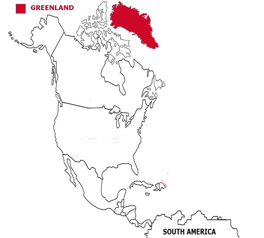
GREENLAND
Greenland is a large island, geographically within North America but more often seen as a part of Europe.
The geographical coordinates for Greenland, also known as lines of latitude and longitude, are:-
Latitude 72 00N
Longitude 40 00W.
Greenland was reached by the Vikings in the 10th century. Danish immigrants arrived in the 18th century and Greenland became a part of Denmark in 1953.
Like Denmark, it joined the EU in 1973 but withdrew in 1985. Greenland was granted self government in 1979 and gained even more self-rule in 2009.
The weather is arctic and temperatures seldom rise above about 7C. The ice-free coastline is where the small towns and settlements are.
Greenland has a total area of 2,166,086 sq kms, of which 410,449 is ice free.
It has a total coastline of 44,087 kms and has no land borders.
Greenland has a total population of 57,713.
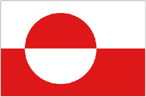
Below is a map showing where Greenland is and the flag of Greenland.
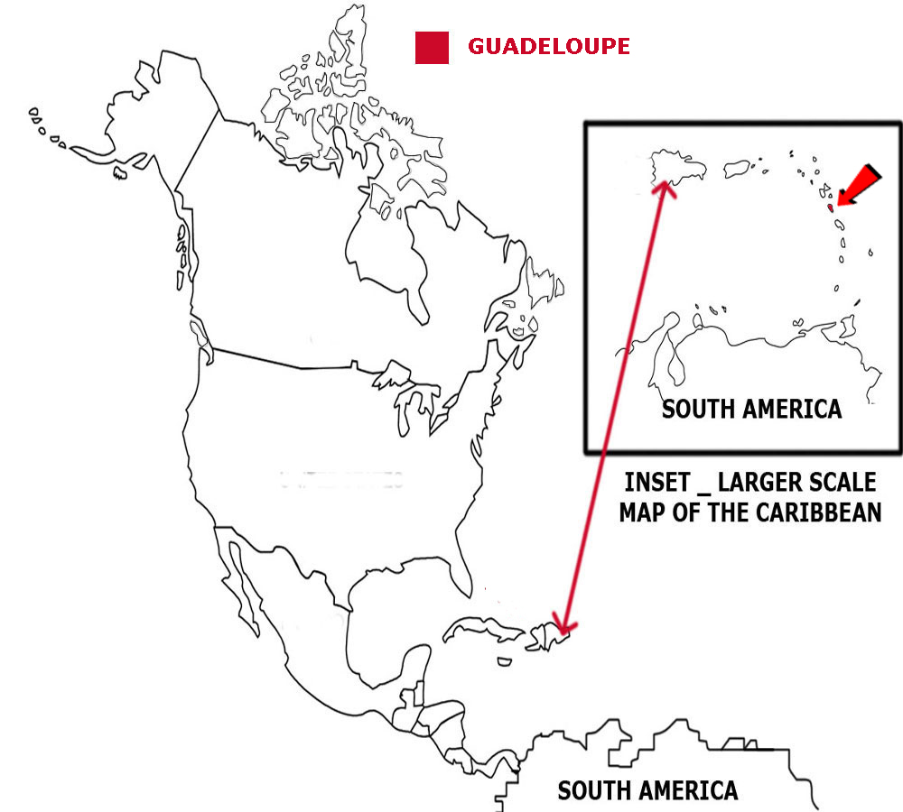
GUADELOUPE
Guadeloupe consists of five islands in the Caribbean Sea, part of the Leeward Island group. The islands are formed from volcanoes.
The geographical coordinates for Guadeloupe, also known as lines of latitude and longitude, are:-
Latitude 16 15N
Longitude 61 35W.
The islands were disputed for many years between France and Britain and even Sweden had control for a while. In 1815 at the Treaty of Vienna, France was granted the islands.
Christopher Columbus is said to have discovered the pineapple on Guadeloupe when he landed there in 1493.
The weather is typically Caribbean. Guadeloupe has a dry season from January to June and a wet season from July to December and, during the hurricane season, the islands are prone to being damaged by the strong winds that can occur.
Guadeloupe has a total area of 1,628 sq kms.
It has a total coastline of 306 kms and has no land borders.
Guadeloupe has a total population of 402,119.
Below is a map showing where Guadeloupe is and the flag of Guadeloupe.
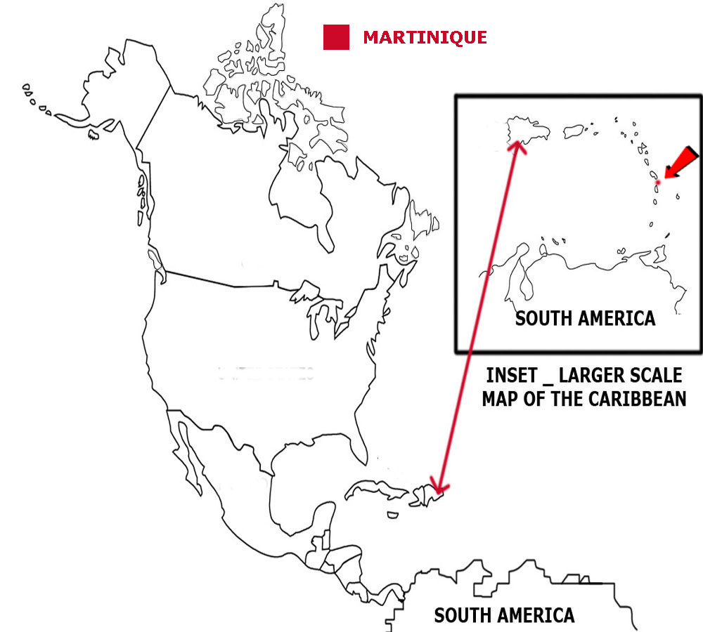
MARTINIQUE
Martinique is an island in the Caribbean Sea, part of the Windward island group. It is volcanic in origin.
The geographical coordinates for Martinique, also known as lines of latitude and longitude, are:-
Latitude 14 40N
Longitude 61 00W.
Britain and France disputed the islands for a while but in 1815 the island was traded back to France by the British.
The weather is typically Caribbean. The temperature hardly varies all year round. During the hurricane season, the islands are prone to being damaged by the strong winds that can occur.
Martinique has a total area of 1,128 sq kms.
It has a total coastline of 350 kms and has no land borders.
Martinique has a total population of 385,551.
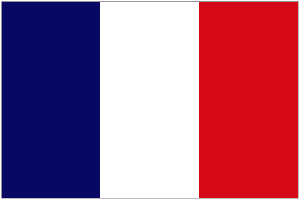
Below is a map showing where Martinique is and the flag of Martinique.

ST BARTHELEMY
Saint Barthelemy is an island in the Caribbean Sea, part of the Leeward island group.
The geographical coordinates for Saint Barthelemy, also known as lines of latitude and longitude, are:-
Latitude 17 90N
Longitude - 62 85W.
Saint-Barthélemy was first claimed by France in 1648. It was sold to Sweden in 1785. Sweden sold it back to France in 1878. The Swedish period left its mark in the names of many of the streets and the town of Gustavia (in honor of King Gustav III).
The weather is typically Caribbean. The temperature hardly varies all year round. During the hurricane season, the islands are prone to being damaged by the strong winds that can occur.
Saint Barthelemy has a total area of 25 sq kms.
It has a total coastline of about 50 kms and has no land borders.
It has a total population of 7,184.
Below is a map showing where Saint Barthelemy is and the flag of Saint Barthelemy.

ST MARTIN
Saint Martin is the northern part of an island in the Caribbean Sea, part of the Leeward island group.
The geographical coordinates for Saint Martin, also known as lines of latitude and longitude, are:-
Latitude 18 05N
Longitude 63 57W.
The whole island was first occupied by the Dutch, then the Spanish before the Dutch retook it. In 1648 the island was divided between the French and the Dutch.
The weather is typically Caribbean. The temperature hardly varies all year round. During the hurricane season, the islands are prone to being damaged by the strong winds that can occur.
Saint Martin has a total area of 54.4 sq kms.
It has a total coastline of 58.9 kms for the whole island and has a land border with Sint Maarten.
It has a total population of 32,125.
Below is a map showing where Saint Martin is and the flag of Saint Martin.


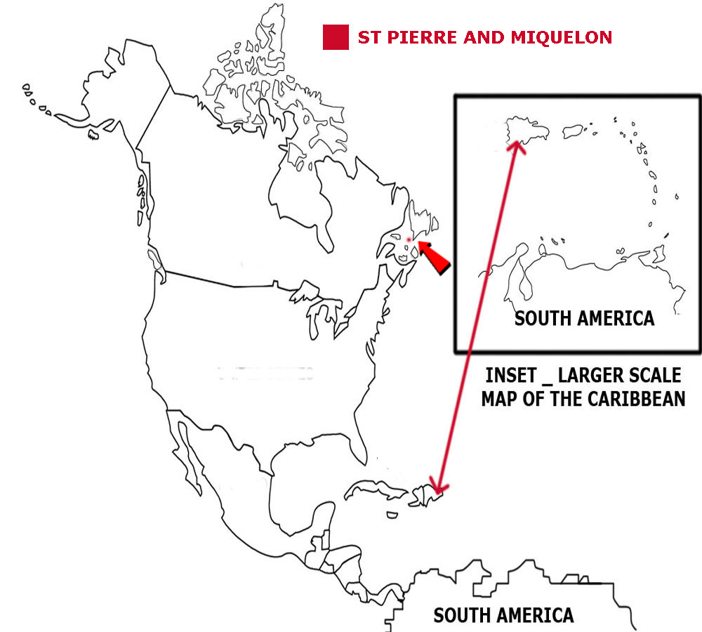
ST PIERRE
Saint Pierre and Miquelon is an island just off the coast of Eastern Canada.
The geographical coordinates for Saint Barthelemy, also known as lines of latitude and longitude, are:-
Latitude 46 50N
Longitude 56 20W.
The island is the last remaining part of what was once the French empire in North America.
The weather is cold and wet with considerable mist and fog.
Saint Pierre and Miquelon has a total area of 242 sq kms.
It has a total coastline of about 120 kms and has no land borders.
It has a total population of 5,533.
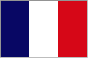
Below is a map showing where Saint Pierre and Miquelon is and the flag of Saint Pierre and Maquelon.

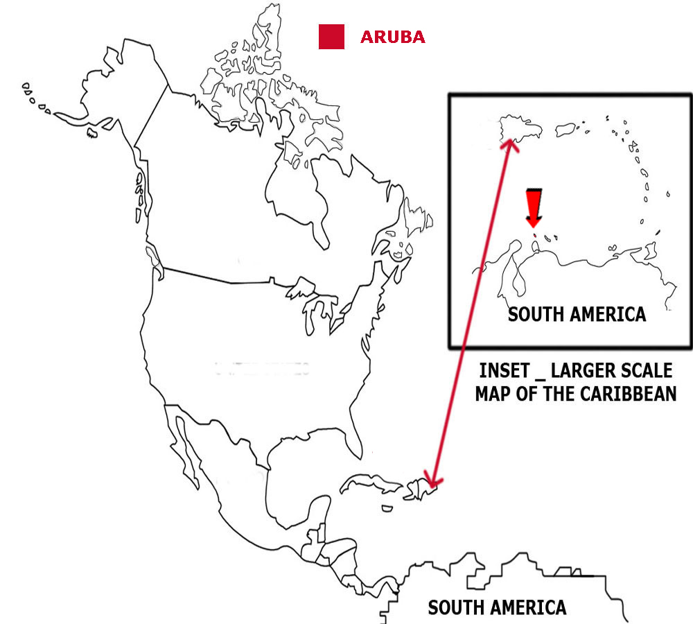
ARUBA
Aruba is an island in the Caribbean off the northern coast of Venezuela.
The geographical coordinates for Aruba, also known as lines of latitude and longitude, are:-
Latitude 12 30N
Longitude 69 58W.
Aruba was acquired by the Dutch in 1636. It became a separate, autonomous member of the Netherlands in 1986.
The weather is typically Caribbean. The temperature hardly varies all year round. During the hurricane season, the islands are prone to being damaged by the strong winds that can occur.
Aruba has a total area of 180 sq kms.
It has a total coastline of 68.5 kms and has no land borders.
It has a total population of 115,120.
Below is a map showing where Aruba is and the flag of Aruba.
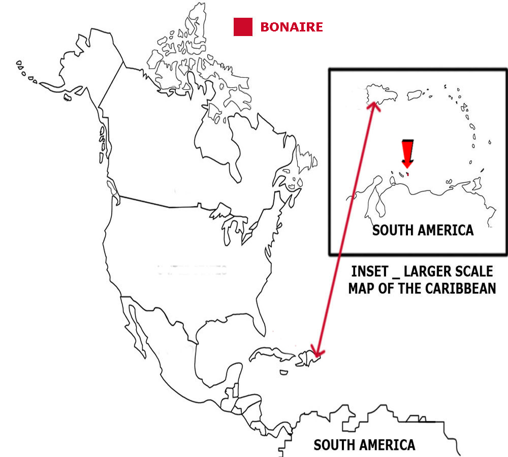
BONAIRE
Bonaire is an island in the Caribbean off the northern coast of Venezuela.
The geographical coordinates for Bonaire, also known as lines of latitude and longitude, are:-
Latitude 12 09N
Longitude 68 16W.
Bonaire was acquired by the Dutch in 1636. It became a separate, autonomous member of the Netherlands in 2010.
The weather is typically Caribbean. The temperature hardly varies all year round. During the hurricane season, the islands are prone to being damaged by the strong winds that can occur.
Bonaire has a total area of 294 sq kms.
It has a coastline of 364 kms and has no land borders.
It has a total population of 18,095.
Below is a map showing where Bonaire is and the flag of Bonaire.
CURACAO
Curacao is an island in the Caribbean off the northern coast of Venezuela.
The geographical coordinates for Curacao, also known as lines of latitude and longitude, are:-
Latitude 12 10N
Longitude 69 00W.
Curacao was settled by the Dutch in 1634. It became a separate, autonomous member of the Netherlands in 2010.
The weather is typically Caribbean. The temperature hardly varies all year round. During the hurricane season, the islands are prone to being damaged by the strong winds that can occur.
Curacao has a total area of 444 sq kms.
It has a total coastline of 364 kms and has no land borders.
It has a total population of 149,648.
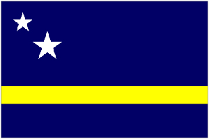
Below is a map showing where Curacao is and the flag of Curacao.

SABA
Saba is an island in the Caribbean Sea, part of the Leeward island group.
The geographical coordinates for Saba, also known as lines of latitude and longitude, are:-
Latitude 17 38N
Longitude 63 15W.
The Netherlands have been in continuous possession of Saba since 1816, after numerous flag changes (British-Dutch-French) during the previous centuries.
By 2016 the island had been French for 12 years, English for 18 years, and Dutch for 345 years. It became a separate, autonomous member of the Netherlands in 2010.
The weather is typically Caribbean. The temperature hardly varies all year round. During the hurricane season, the islands are prone to being damaged by the strong winds that can occur.
Saba has a total area of 13 sq kms.
It has a total coastline of about 15 kms and has no land borders.
It has a total population of 1,191.
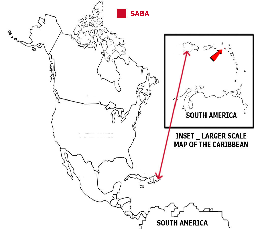
Below is a map showing where Saba is and the flag of Saba.
SINT EUSTATIUS
Sint Eustatius is an island in the Caribbean Sea, part of the Leeward island group.
The geographical coordinates for Sint Eustatius, also known as lines of latitude and longitude, are:-
Latitude 17 29N
Longitude 62 59W.
The Netherlands have been in possession of Sint Eustatius since 1636. It became a separate, autonomous member of the Netherlands in 2010.
The weather is typically Caribbean. The temperature hardly varies all year round. During the hurricane season, the islands are prone to being damaged by the strong winds that can occur.
Sint Eustatius has a total area of 21 sq kms.
It has a total coastline of about 25 kms and has no land borders.
It has a total population of 3,193.
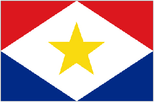
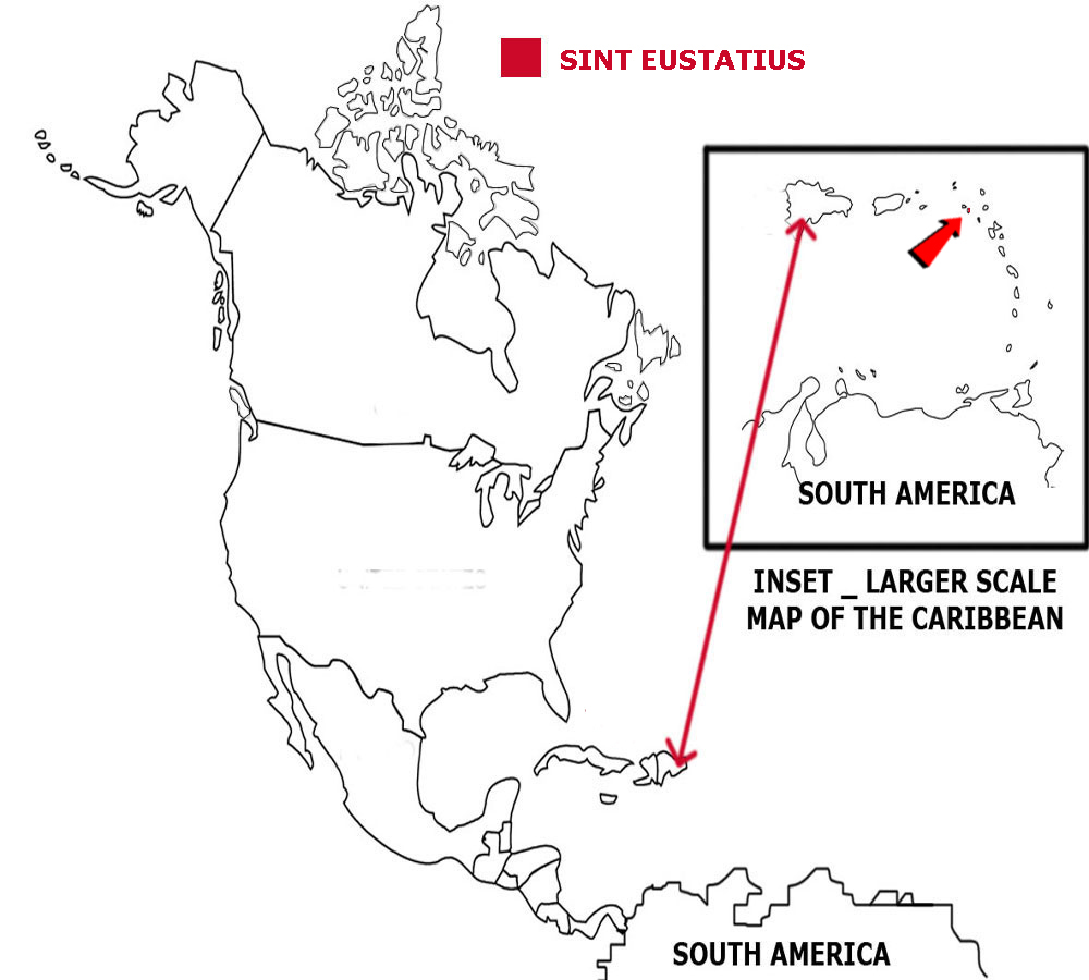
Below is a map showing where Sint Eustatius are and the flag of Sint Eustatius.
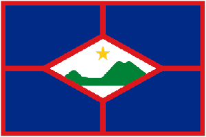
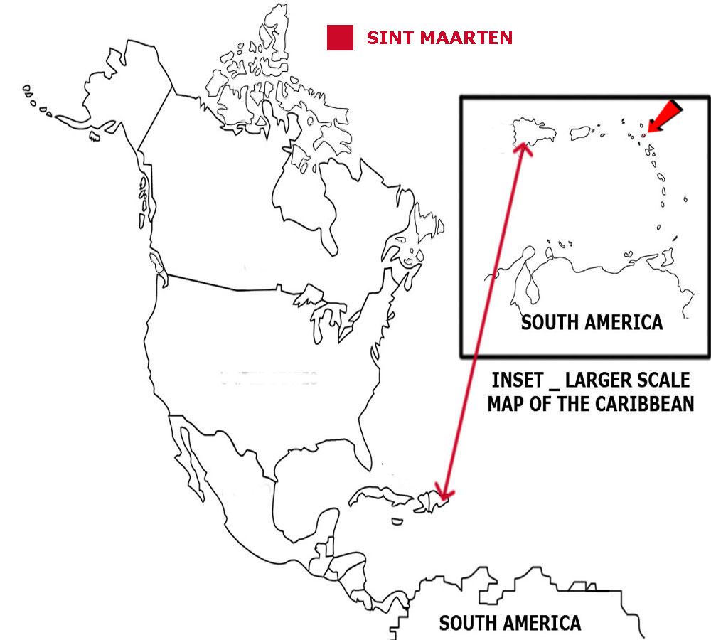
SINT MAARTEN
Sint Maarten is the southern part of an island in the Caribbean Sea, part of the Leeward island group.
The geographical coordinates for Sint Maarten, also known as lines of latitude and longitude, are:-
Latitude 18 04N
Longitude 63 04W.
The whole island was first occupied by the Dutch, then the Spanish before the Dutch retook it. In 1648 the island was divided between the French and the Dutch.
The weather is typically Caribbean. The temperature hardly varies all year round. During the hurricane season, the islands are prone to being damaged by the strong winds that can occur.
Sint Maarten has a total area of 34 sq kms.
It has a total coastline of about 58.9 kms for the whole island and has a land border with Saint Martin.
It has a total population of 42,083.
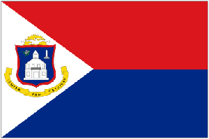
Below is a map showing where Sint Maarten is and the flag of Sint Maarten.
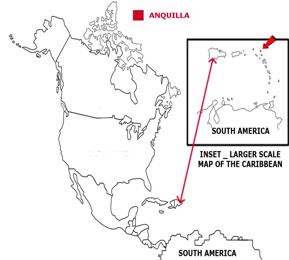
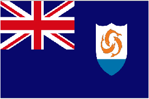
ANQUILLA
Anquilla is a group of small islands in the Caribbean Sea, part of the Leeward island group.
The geographical coordinates for Anquilla, also known as lines of latitude and longitude, are:-
Latitude 18 15N
Longitude 63 10W.
Anquilla was first settled by English settlers from St Kitts in 1650 and was then included into a single dependency with St Kitts and Nevis. It
became a separate dependency in 1980.
The weather is typically Caribbean. The temperature hardly varies all year round. During the hurricane season, the islands are prone to being damaged by the strong winds that can occur.
Anquilla has a total area of 91 sq kms.
It has a total coastline of 61 kms and has no land borders.
It has a total population of 17,087.
Below is a map showing where Anquilla is and the flag of Anquilla.
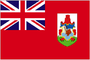
BERMUDA
Bermuda is a group of small islands in the North Atlantic Ocean.
The geographical coordinates for Bermuda, also known as lines of latitude and longitude, are:-
Latitude 32 20N
Longitude 64 45W.
Bermuda was first settled by English colonists who were shipwrecked when heading to Virginia. It is the oldest British overseas territory and has been
self-governing since 1620.
The weather is mild and humid with strong winds in the winter. During the hurricane season, the islands are prone to being damaged by the strong winds that can occur.
Bermuda has a total area of 54 sq kms.
It has a total coastline of 103 kms and has no land borders.
It has a total population of 70,864.
Below is a map showing where Bermuda is and the flag of Bermuda.
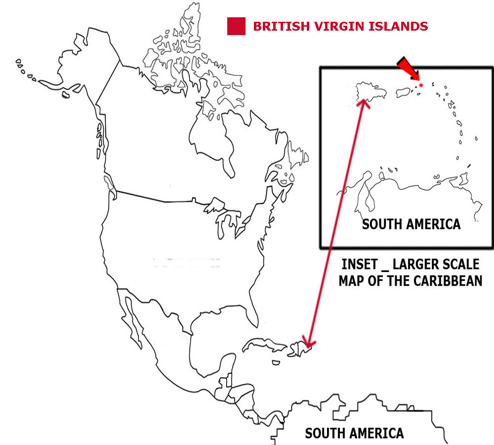
BRITISH VIRGIN ISLAND
The British Virgin Islands are a group of small islands in the Caribbean Sea, part of the Leeward island group.
The geographical coordinates for the British Virgin Islands, also known as lines of latitude and longitude, are:-
Latitude 18 30N
Longitude 64 30W.
The British Virgin Islands were settled by the Dutch in 1648 and then taken over by the English in 1672. They gained autonomy in 1967.
The weather is typically Caribbean. The temperature hardly varies all year round. During the hurricane season, the islands are prone to being damaged by the strong winds that can occur.
The British Virgin Islands have a total area of 151 sq kms.
It has a total coastline of 80 kms and has no land borders.
It has a total population of 35,015.
Below is a map showing where the British Virgin Islands are and the flag of the British Virgin Islands.
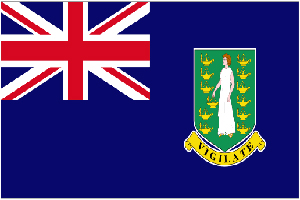
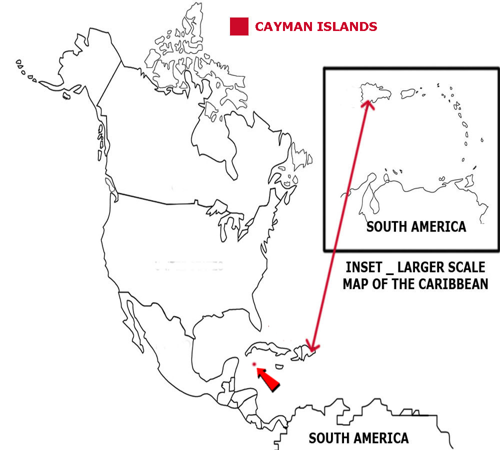
CAYMAN ISLANDS
The Cayman Islands are a group of small islands in the Caribbean Sea.
The geographical coordinates for the Cayman Islands, also known as lines of latitude and longitude, are:-
Latitude 19 30N
Longitude 80 30W.
The Cayman Islands were first settled by the British in the 18th century and, after 1863, were administered by Jamaica. They became a British dependency in 1962.
The weather is typically Caribbean. The temperature hardly varies all year round. During the hurricane season, the islands are prone to being damaged by the strong winds that can occur.
The Cayman Islands have a total area of 264 sq kms.
It has a total coastline of 160 kms and has no land borders.
It has a total population of 58,441.
Below is a map showing where the Cayman Islands are and the flag of the Cayman Islands.

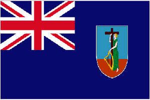
MONTSERRAT
Montserrat is an island in the Caribbean Sea, part of the Leeward island group.
The geographical coordinates for Monserrat, also known as lines of latitude and longitude, are:-
Latitude 16 45N
Longitude 62 12W.
Monserrat was first settled by English settlers from St Kitts in 1632. The British and French fought over the islands for many years. It finally became
British in 1783. Much of the island was devasted and two-thirds of the population left when the Soufriere Hills volcano erupted in 1995.
The weather is typically Caribbean. The temperature hardly varies all year round. During the hurricane season, the islands are prone to being damaged by the strong winds that can occur.
Montserrat has a total area of 102 sq kms.
It has a total coastline of 40 kms and has no land borders.
It has a total population of 5,292.
Below is a map showing where Montserrat is and the flag of Monserrat.

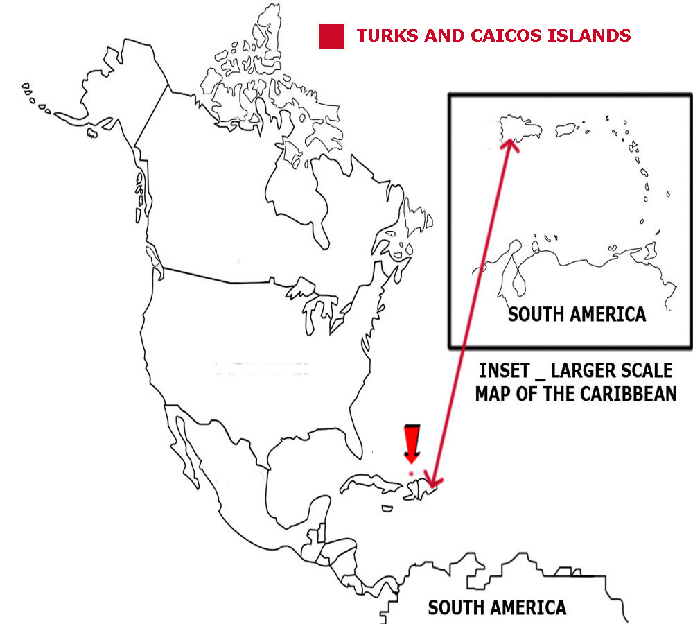
TURKS AND CAICOS
The Turks and Caicos Islands are a group of small islands in the North Atlantic Ocean.
The geographical coordinates for the Turks and Caicos Islands, also known as lines of latitude and longitude, are:-
Latitude 21 45N
Longitude 71 35W.
The Turks and Caicos Islands were under Jamaican control under 1962. They were then overseen by the governor of The Bahamas until 1973. They had their own governor from that date.
The weather is tropical, sunny and warm. During the hurricane season, the islands are prone to being damaged by the strong winds that can occur.
The Turks and Caicos Islands have a total area of 948 sq kms.
They have a total coastline of 389 kms and have no land borders.
They have a total population of 52,570.
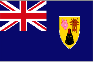
Below is a map showing where the Turks and Caicos Islands are and the flag of the Turks and Caicos Islands.
PUERTO RICO
Puerto Rico is an island in the Caribbean Sea, part of the Leeward island group.
The geographical coordinates for Puerto Rico, also known as lines of latitude and longitude, are:-
Latitude 18 15N
Longitude 66 30W.
Puerto Rico was ruled by Spain from 1493 but given to the United States of America in 1898. Puerto Ricans were granted US citizenship in 1917.
The weather is typically Caribbean. The temperature hardly varies all year round. During the hurricane season, the islands are prone to being damaged by the strong winds that can occur.
Puerto Rico has a total area of 9,104 sq kms.
It has a total coastline of 501 kms and has no land borders.
It has a total population of 3,351,827.
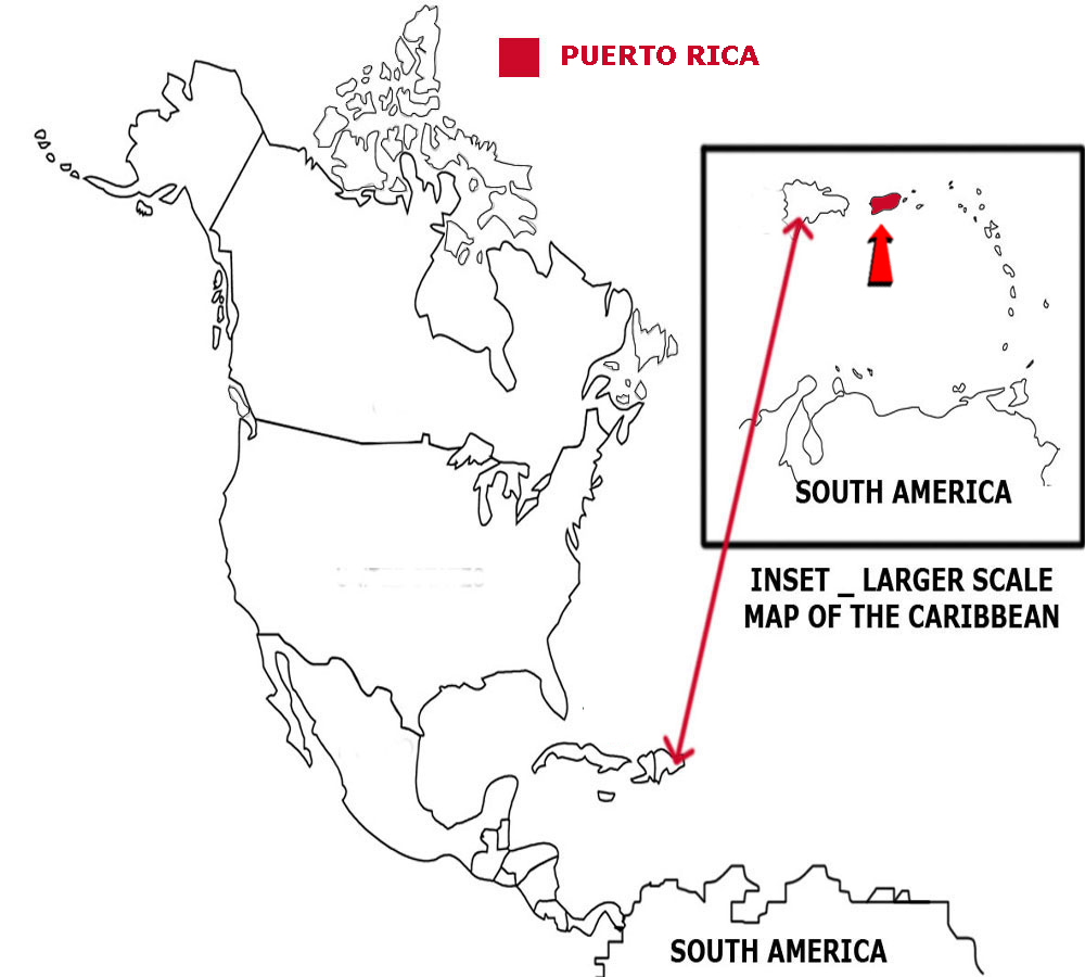
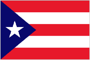
Below is a map showing where Puerto Rico is and the flag of Puerto Rico.
US VIRGIN ISLANDS
The US Virgin Islands are a group of small islands in the Caribbean Sea, part of the Leeward island group.
The geographical coordinates for the US Virgin Islands, also known as lines of latitude and longitude, are:-
Latitude 18 20N
Longitude 64 50W.
The US Virgin Islands were under Danish control until 1917 when they were purchased by the United States of America.
The weather is typically Caribbean. The temperature hardly varies all year round. During the hurricane season, the islands are prone to being damaged by the strong winds that can occur.
The US Virgin Islands have a total area of 346 sq kms.
They have a total coastline of 188 kms and have no land borders.
They have a total population of 107,268.
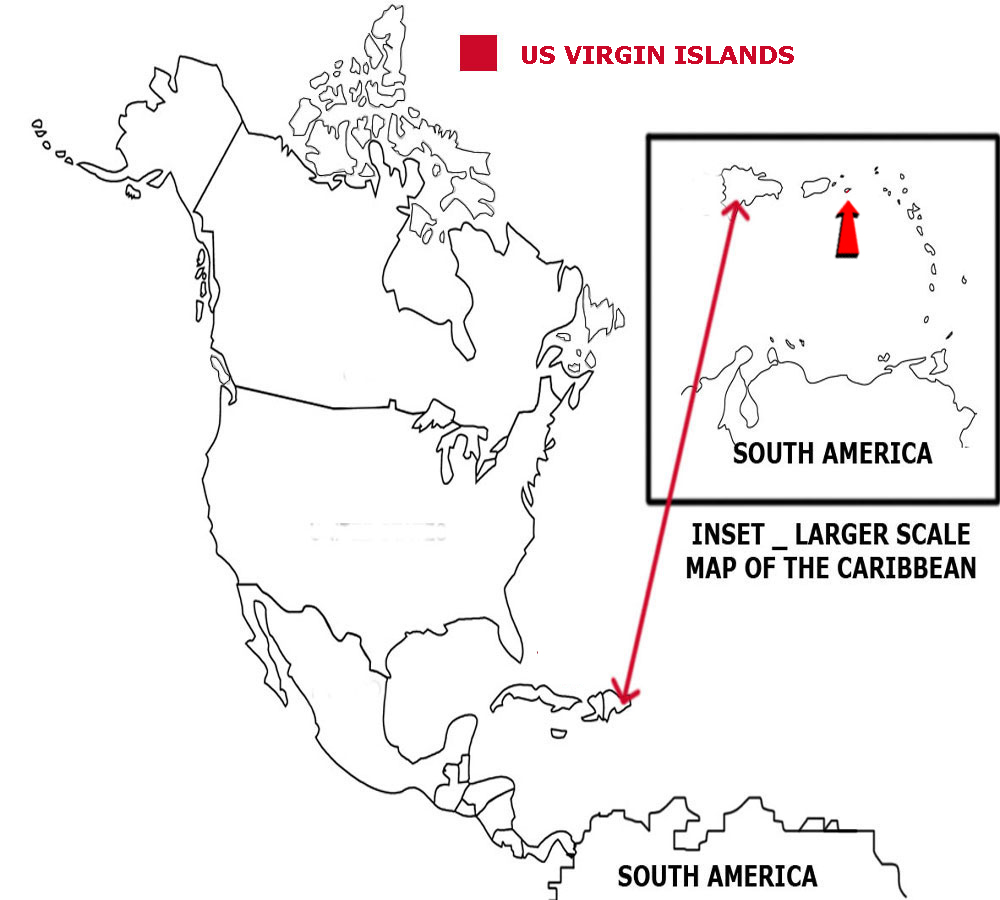
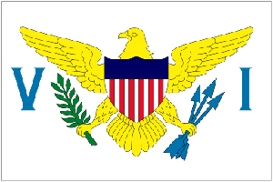
Below is a map showing where the US Virgin Islands are and the flag of the US Virgin Islands.
![]()