


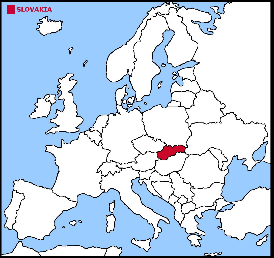
Slovakia is an average size country in eastern Europe.
Slovakia is a landlocked country with no coastline.
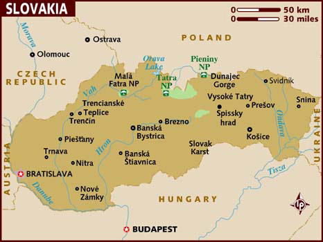
The land is mountainous in the north and centre with lowlands in the south.
The geographical coordinates for the centre of Slovakia, also known as lines of latitude and longitude, are:-
Latitude - 48 40N
Longitude - 19 30E
The capital of Slovakia is Bratislava.
Slovakia is a parliamentary republic with a president as head of state and a prime minister as head of the government.
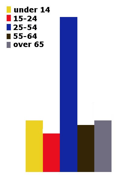
In elections everyone over the age of 18 can vote.
The currency in Slovakia is the euro. Slovakia is a member of the European Union, having joined in 2004.
Slovak is the official language.
Check the weather in Bratislava now.
This is the time in Bratislava now
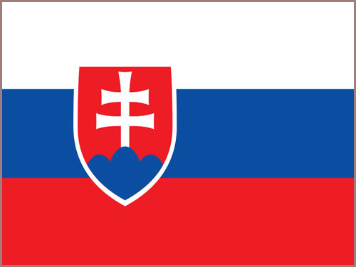 The Slovakian flag is 3 equal horizontal stripes
of white, blue and red. The Slovakian coat of arms is in the centre but slightly offset to the left. The coat of arms is a red shield with a white border
with the double barred cross of St Cyril and St Methodius on top of 3 blue hills.
The Slovakian flag is 3 equal horizontal stripes
of white, blue and red. The Slovakian coat of arms is in the centre but slightly offset to the left. The coat of arms is a red shield with a white border
with the double barred cross of St Cyril and St Methodius on top of 3 blue hills.


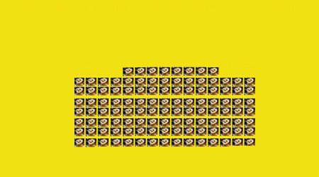
 Each little Owlbut is 1 person and
the big yellow rectangle is 1 sq km. After a while you can compare countries and see which ones are the most crowded. Remember it is only an average as
more people live closer together in towns and cities than in villages out in the country.
Each little Owlbut is 1 person and
the big yellow rectangle is 1 sq km. After a while you can compare countries and see which ones are the most crowded. Remember it is only an average as
more people live closer together in towns and cities than in villages out in the country.


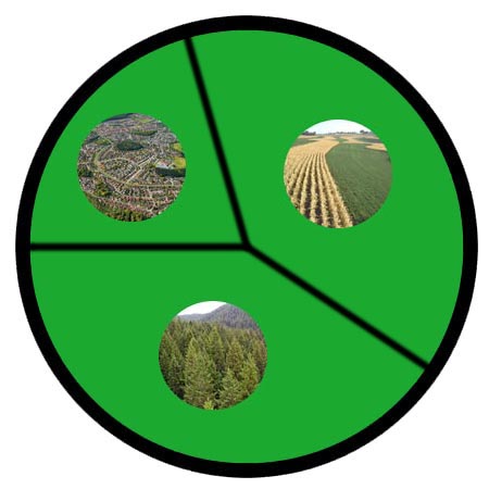
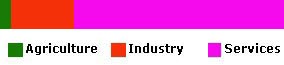 They work in the following sectors.